P / 01
Sea level is rising
Rising sea level and more frequent storm surges are expected to increase coastal flooding and erosion risk. The baseline the existing structures were designed against is not the baseline they will face.
 Back to Home
Background Context
Singapore is an island that has spent a century drawing and redrawing its own edge. Almost nothing about the shoreline you can walk to today is accidental. It was surveyed, argued over, filled, graded, planted and armoured. Understanding that is the whole argument for what comes next — because a made coastline can also be remade, and this time it can be made to hold life.
The drawings on this page are analytical plates from the SHIELD Living Lab research — the coastal reading that sits underneath the reef design.
A made coastline
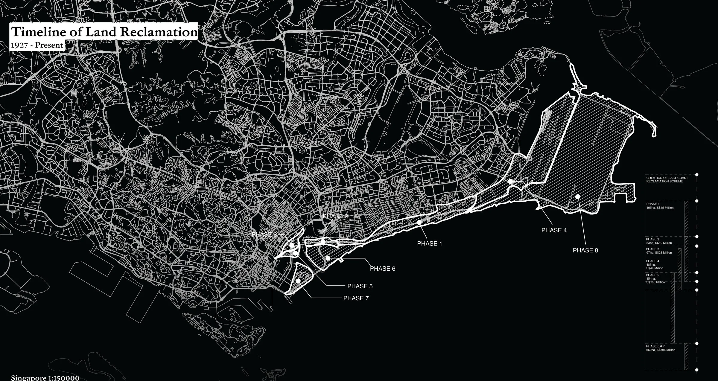
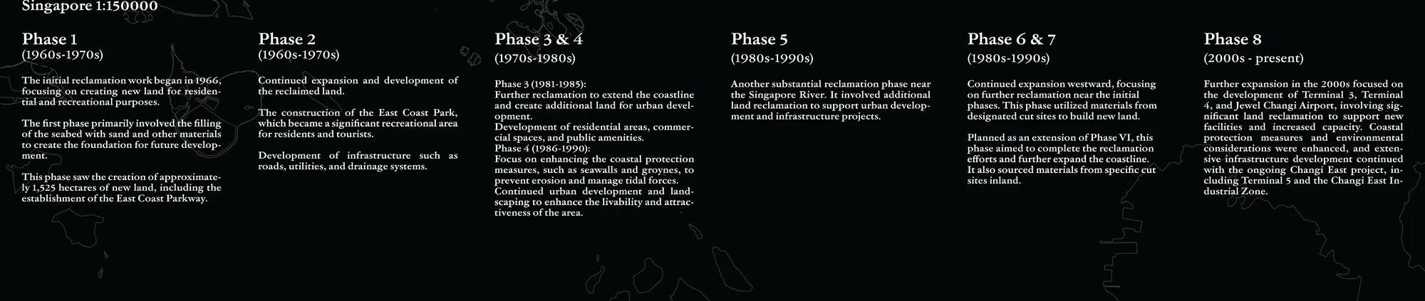
Singapore has expanded through successive phases of land reclamation running from 1927 to the present. Each phase pushed the waterline outward: harbour works, industrial estates, airport land, new towns, parks. The island on today's map is not the island on the earliest survey sheets.
This matters for a very practical reason. The East Coast most Singaporeans think of as "the beach" is reclaimed land. It is a designed edge — a fill platform with a beach laid on top of it and a defensive structure holding the whole thing in place. It behaves like a piece of infrastructure, because that is what it is.
So when we talk about "protecting the coastline", we are not protecting a natural landform that has always been there. We are maintaining a construction. That reframes the question: not how do we defend what nature gave us, but what kind of edge do we want to build next.
Reading the island four ways
The study read Singapore through four separate layers: where its ecosystems survive, where its land was made, where its energy and infrastructure concentrate, and where water is expected to go. Drawn apart, they look like four different islands. Laid over each other, they describe one problem.
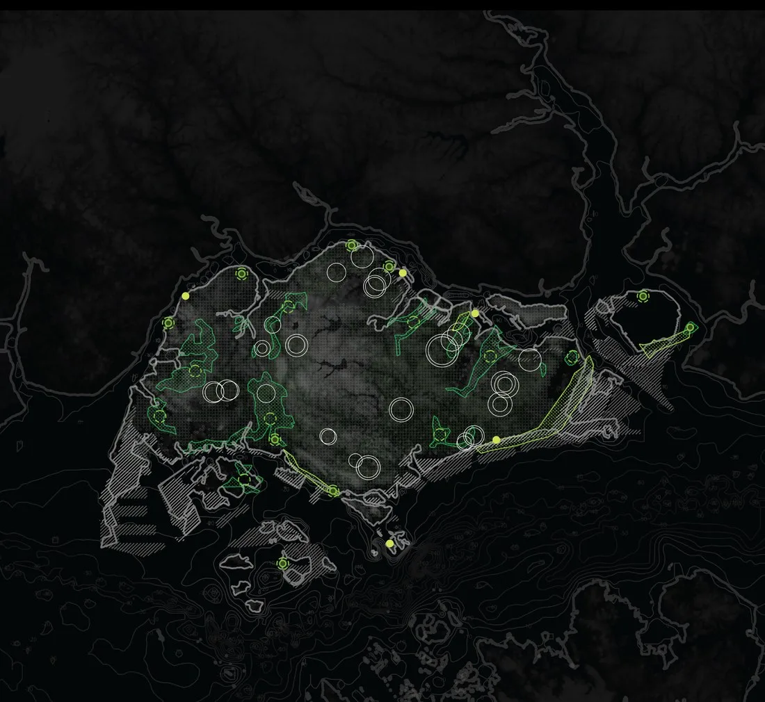
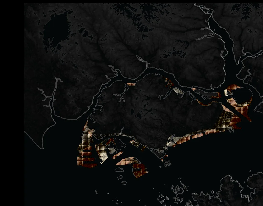
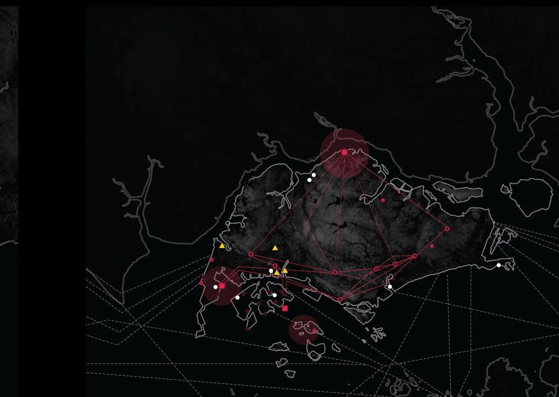
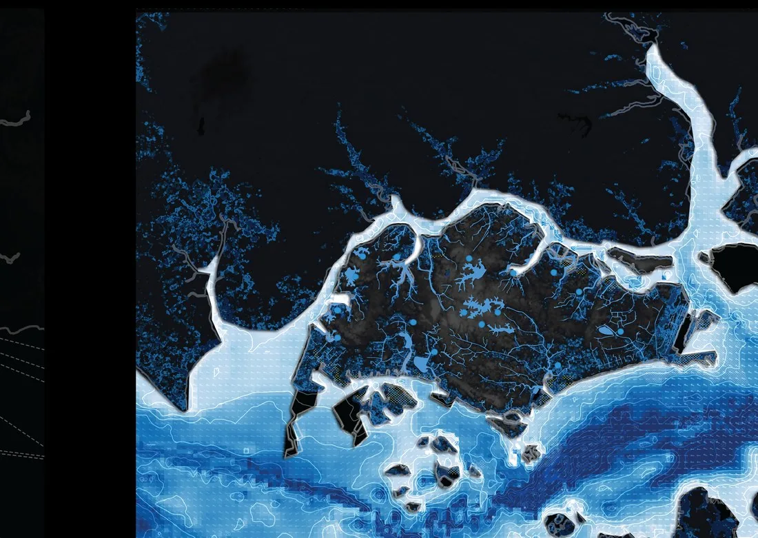
Every one of these layers converges on the same narrow coastal strip. The ecology, the made ground, the infrastructure and the risk are all stacked in the same few hundred metres of shore.
That overlap is the design brief. Any intervention on this coast has to work on all four layers at once, because there is no room to solve them one at a time.
The hard edge
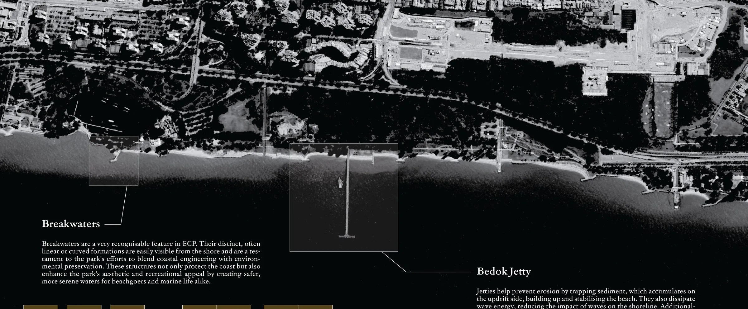
East Coast Park · breakwaters and Bedok Jetty
It is worth being fair about this, because the structures work. Approximately 70% of Singapore's coastline is guarded by hard engineering, and that engineering is effective at present. It has kept a low-lying, densely built island dry and stable through decades of growth. Nobody should pretend otherwise.
The limitation is narrower and more interesting than "concrete is bad". These structures usually serve a single function — coastal protection. They are generally less biodiverse than the shorelines they replaced, and they are poorly integrated with human recreational activity. A seawall does one job well and the other jobs not at all.
So the question is not whether to remove them. It is whether the next increment of coastal defence can be asked to do more than one thing.
A shoreline that keeps moving
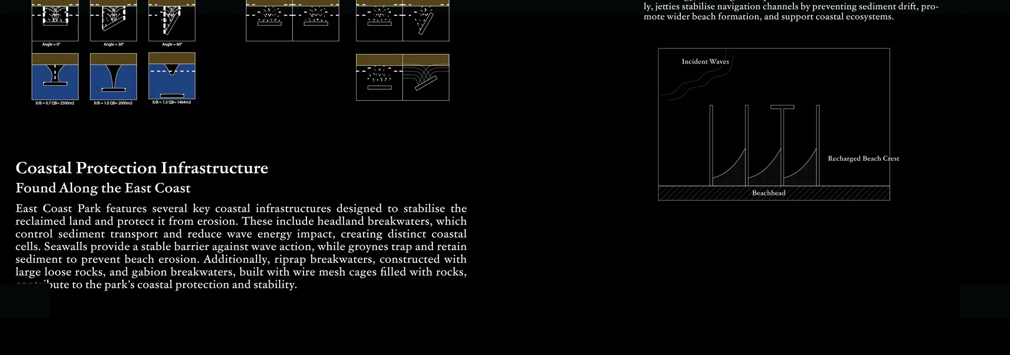
A built coastline is not a finished coastline. Sediment moves along this shore continuously, driven by waves and currents that do not care where the design drawings stopped. Sand is taken from one stretch and put down on another.
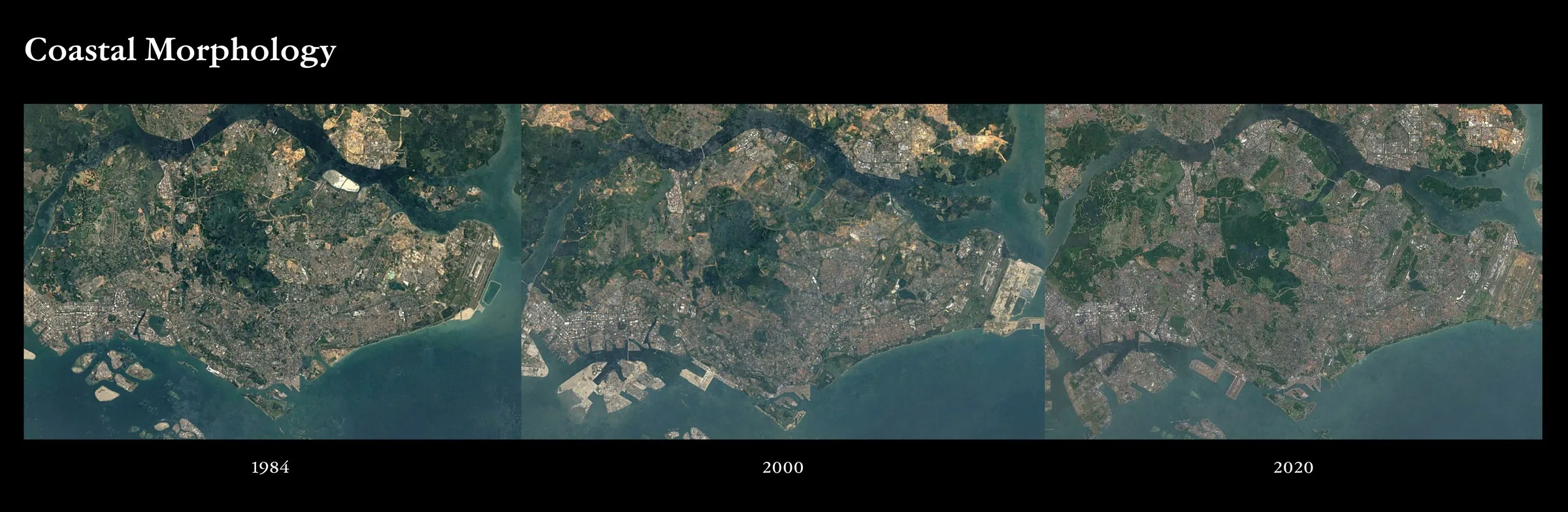
That is why the beaches here need continual management. The satellite record makes the movement legible: compare 1984, 2000 and 2020 and the eastern tip of the island is visibly transformed — new ground, new alignments, a shoreline redrawn within a single lifetime.
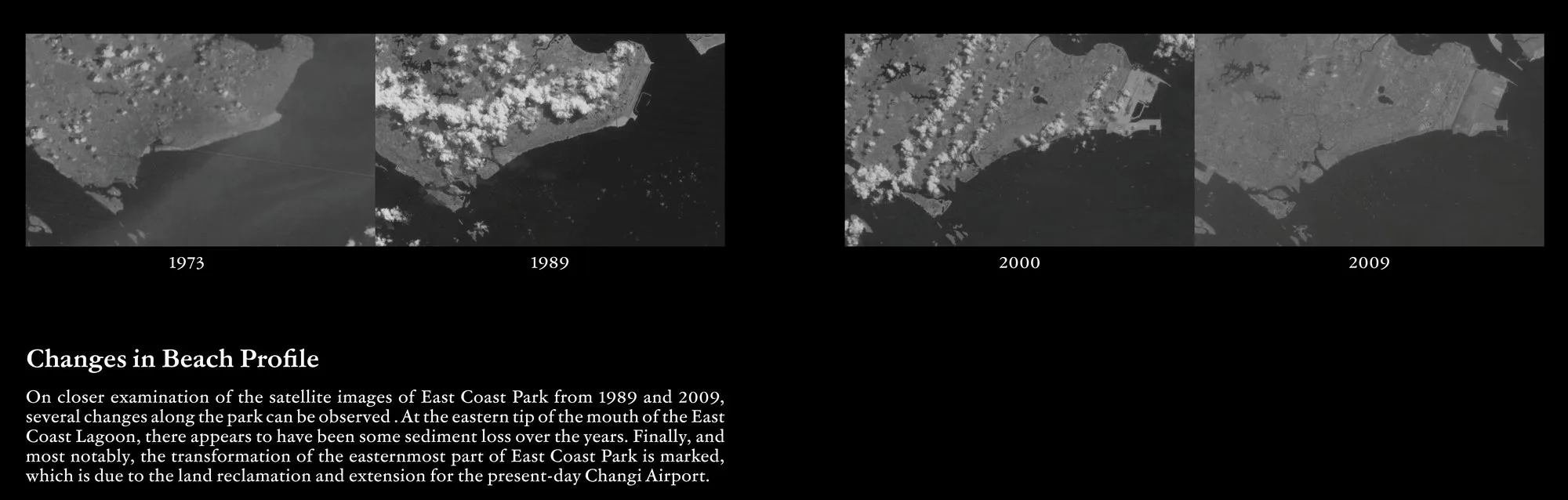
Look closer still, at the beach profile itself across 1975, 1989, 2000 and 2009, and the same restlessness shows up at a smaller scale. The line advances and retreats. Holding it in place is an ongoing act, not a one-time build.
Pressure from the sea
Everything above describes a coastline that is already working hard. Now add the forecast.
P / 01
Rising sea level and more frequent storm surges are expected to increase coastal flooding and erosion risk. The baseline the existing structures were designed against is not the baseline they will face.
P / 02
Waves may become more energetic. More energy arriving at the shore means more force on every seawall, revetment and breakwater already in place, and more sediment moved from every beach.
P / 03
Singapore's dense urban coastline offers little spare land or sea space. There is no wide buffer to retreat into and no empty water to expand across. The constraint is spatial before it is financial.
The default response to a harder sea is a harder wall. On this island, that response is expensive in exactly the resource it consumes most: space.
Build higher and you take more land or more sea. Build wider and you take more of both. A structure that only defends will keep asking for room that the maps in section 02 show simply is not there. Which is the pivot point of this whole project: if the next intervention has to occupy scarce coastal space, it had better earn that space several times over.
Another way to hold a shoreline
Shellfish reefs are the alternative on the table. A dense mass of shell sitting in the intertidal zone dissipates wave energy before it reaches the shore, and increases sedimentation behind it — trapping and holding material instead of letting it wash through.
At the same time it does the thing a seawall cannot: it enhances biodiversity. The structure is habitat by definition. Shell surface is what shellfish and a long list of other intertidal organisms settle on, so the defence and the ecology are the same object rather than two competing claims on the same metre of coast.
None of this is speculative. Shellfish reefs are well proven for wave dissipation and biodiversity globally. The gap is specific and it is ours: they have not been tested at large scale in the tropics, including Singapore.
Precedents
USA
Staten Island, New York. Ecologically enhanced breakwaters built for coastal protection, developed alongside the Billion Oyster Project — defence structures deliberately designed to be colonised.
AUS
Australia. National-scale oyster reef restoration run by The Nature Conservancy with the Australian Government — proof that shellfish reef work can be organised as programme, not one-off pilot.
NLD
Oyster reefs in the Scheldt estuary used for wave dissipation, plus Droppable Oyster Structures (DOS) introducing shellfish to offshore wind farms — reef-building attached to infrastructure that was going in anyway.
The catch
All three are temperate.
Every established precedent was optimised for a cold-water climate — different species, different growth rates, different seasons, different engineering. None of it transfers unmodified to a shoreline sitting almost on the equator. Singapore's version of this has to be invented here, in tropical water, on a made coast, against a monsoon.
The local proof
In 2023–2024, Witteveen+Bos piloted Singapore's first artificial oyster reef, using bagged shellfish units. It was small. It worked.
Richness
Species richness tripled. Put shell in the water in a form that organisms can use, and in this climate they use it. That is the single most encouraging result in the whole background, because it says the tropical gap is a gap in testing, not a gap in biology.
Recruitment
Spat recruitment was observed on 49% of shells. Recruitment is the difference between a pile of shell and a reef: it means new live shellfish are settling on the structure and will, over time, cement it together and make it stronger rather than letting it decay.
Cleaning
The pilot also proved the cleaning method. Sufficient UV exposure from the sun naturally sterilises the surface of oyster shells, and marine species cannot survive such prolonged desiccation. That is how the invasive-species risk gets closed — with sunlight and time, not chemicals.
Lesson
One practical lesson carried straight into SHIELD: double-bag the shells. It reduces material ripping and lowers maintenance cost. Small detail, and exactly the kind of thing you only learn by putting a real structure in real water.
This is where the page turns hopeful. The coastline is made, the maps all converge, the sea is getting harder — and there is now local evidence that shell in tropical water becomes habitat fast.
SHIELD — Shellfish Habitats for Integrated EcoLogical Defence — takes that result and asks what it looks like at the scale of actual coastal protection. That is the next page.
Onward
You now have the coastline. Three short steps from here, depending on what you want to do with it.
Next
The anatomy of a SHIELD module — steel cages, shell bags, Biorock accretion, and where it sits in the intertidal zone.
Material
Oysters, mussels and cockles from local restaurants — what counts as usable material and what does not.
You
Local organisations are being engaged to help with preparation works — collecting and processing shellfish material from restaurants.
Questions about the research
Ask us something specific.
If you work on this coast, teach about it, or run a restaurant with a bin full of shells, we would rather hear from you than not. Short emails are fine.